Kyoto Beyond the Main Street: A Guide to Quieter Neighborhood Walks
Kyoto rewards a traveler who can leave space between landmarks. A narrow canal, the sound of a bicycle bell, and a shop curtain moving in the breeze often explain the city better than another hurried photograph of a famous gate.
A different way to arrive
Kyoto rewards a traveler who can leave space between landmarks. A narrow canal, the sound of a bicycle bell, and a shop curtain moving in the breeze often explain the city better than another hurried photograph of a famous gate. This guide connects several different neighborhood experiences without pretending they fit neatly into one continuous walk. Choose a district for the morning, understand how it relates to the surrounding hills or river, and give the ordinary streets as much attention as the destination.
Begin beside the Kamo River
The Kamo River is one of the easiest places to understand Kyoto at walking speed. Paths beside the water create a break from traffic, while bridges provide useful orientation points. The scenery changes subtly as the city stretches north: central riverbanks feel closely tied to shops and stations, while farther upstream the view opens toward mountain edges. Walk one bank out and cross back on a proper bridge instead of turning the route into a contest to cover both sides. Stepping stones can be slippery or submerged and are not essential to enjoying the river.
Build the outing around a bridge-to-bridge stretch and a nearby neighborhood meal; leave the river when the sun becomes uncomfortable rather than forcing a distance target.
Follow the canal through Okazaki
Okazaki brings together a canal, cultural institutions, broad approaches, and residential lanes. Its generous public spaces feel quite different from the compressed streets of the central shopping districts. Use the canal as the spine of a short walk, then turn toward a museum or a garden according to your interests. The point is not to enter every building. A single thoughtful stop gives the district shape, leaving enough time to notice changes in the streets beyond the main approaches.
Check an institution’s own opening information before making it the anchor; keep a canal-side walking alternative for a closure or a crowded entrance.
Give the Philosopher’s Path a wider frame
The Philosopher’s Path follows a canal along the eastern side of the city. Its reputation can make it busy, especially during popular blossom periods, but the surrounding geography remains useful: water below, wooded temple slopes above, residential streets between. Approach it as one part of a neighborhood rather than a corridor to finish. A quieter parallel street may offer a welcome pause, although private gardens and narrow residential access lanes are not public attractions.
Use signed public routes, keep conversation soft near homes, and choose one nearby temple rather than treating every gateway as a required stop.
Look carefully in Nishijin
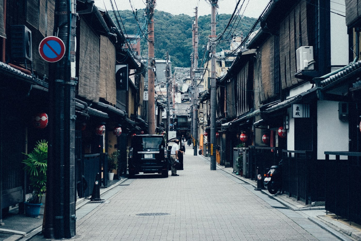
Nishijin is associated with Kyoto’s weaving traditions, but its interest lies in a lived neighborhood rather than a single display. Workshops, older wooden buildings, small shrines, and newer homes coexist. It helps to look at the rhythm of frontages and entrances without expecting each building to explain itself. Some textile-related premises welcome visitors; others are working spaces. A closed door is simply a closed door, and a studio should not become an uninvited photographic subject.
Select a clearly visitor-facing textile stop in advance and use the walk between it and a public shrine to notice the district’s street pattern.
Use Higashiyama’s edges
The most familiar streets around southern Higashiyama can carry intense foot traffic. Instead of trying to find an impossible empty version of the same scene, change the scale of the day. Walk toward a less crowded public approach, choose a side street that is clearly open, and study details such as rooflines and the slope of the land. Some Gion lanes have access or photography restrictions; signs and local requests take precedence over an online route.
Avoid entering private lanes for an image, keep doorways clear, and accept that a district can be appreciated without photographing its residents.
Eat close to the walk
A neighborhood lunch makes the day easier than a cross-city journey to a fashionable address. Look for a menu you understand, a clearly open entrance, and a setting that matches your appetite. Small establishments may have limited seats and a particular ordering routine. Observe before entering, ask politely when unsure, and avoid lingering with luggage when space is scarce. Convenience food can also make sense, provided it is eaten where permitted and packaging is carried to an appropriate bin.
Keep a simple fallback near a main street, especially when walking outside central districts where afternoon service may be limited.
Move between districts deliberately
Kyoto’s appealing neighborhoods are spread out. A route that looks compact on a city map can become tiring when heat, crowds, and repeated stops are added. Rail, subway, buses, and walking can each serve a different portion of the day; choose connections using current official information. Staying in one area until lunch often produces a more coherent experience than crossing the city repeatedly. A return journey should be settled before tired feet start making decisions.
Treat the river, eastern foothills, and central grid as separate orientation tools, and plan one major district change at most in a relaxed day.
Let the small observations remain small
Travel writing often makes Kyoto sound like a collection of hidden discoveries. That language can encourage intrusive behavior in ordinary neighborhoods. A more useful approach is to enjoy what is publicly visible without claiming possession of it. A shop window, a seasonal display at a doorway, or a street disappearing toward the hills can be memorable precisely because nothing dramatic happens. The walk ends well when you still have enough attention to notice the journey back.
Carry a compact bag, leave room for bicycles to pass, and finish with a short river or station-area walk instead of adding another distant attraction.
Three useful neighborhood anchors
Demachiyanagi offers a clear northern river reference, where the Kamo and Takano rivers meet. That confluence helps explain why a river walk can feel broader and more open here than in the central city. It is a useful place to begin a modest bridge-to-bridge outing rather than a demand to walk all the way downtown. Look at the two branches of water, choose one public path, and keep the return crossing clear in your mind. The riverbank is shared with people exercising, cycling, and resting. Leave the main line of movement before checking a map or arranging a group photograph.
In Okazaki, the Kyoto City KYOCERA Museum of Art provides a concrete cultural anchor. Its setting allows a visitor to connect an indoor art interest with the district’s canal and broader public spaces. Check the museum’s own current exhibition and admission information, because a building you want to see and an exhibition you want to enter are separate decisions. The nearby Heian Shrine approach belongs to a different kind of setting, so allow the transition to be a walk rather than a hurried link. Wide approaches may still carry events, maintenance, or busy pedestrian activity. Follow the current signs instead of assuming an open space is unrestricted.
For the Philosopher’s Path area, Ginkaku-ji and Nanzen-ji help establish the larger eastern geography, but visiting both interiors is not required to enjoy the canal district. Choose the end that best fits your arrival connection and one principal visit. The canal is part of a wider water system, which makes it worth noticing as infrastructure as well as scenery. Water, bridges, and the wooded edge give the walk continuity even outside a celebrated blossom period. A short section can be enough when the route is crowded. Stay on public paths, avoid private frontage, and let any temple visit follow its own rules for entry and photography. These three anchors offer different scales of Kyoto: the river confluence, the cultural district, and the eastern foothill canal. Keeping them distinct makes it easier to select a coherent morning rather than assemble an exhausting cross-city route.
Two mornings instead of one crowded day
For a first neighborhood morning, use the Kamo River to begin gently, then choose Okazaki as the main district. The river walk establishes the scale of the city before the canal and a single cultural stop provide a different kind of attention. Lunch can remain nearby. If there is still energy afterward, a short public-street loop is enough; there is no need to travel immediately to the other side of Kyoto. This arrangement also makes it easy to reduce walking when heat or rain arrives. The essential sequence is open space, a focused visit, and a comfortable meal, with each transition kept manageable.
A second morning can take a different shape in Nishijin. Start with a clearly visitor-facing textile business or cultural stop whose arrangements you have checked, then walk the surrounding public streets. That gives the outing a reason beyond searching for picturesque buildings. Compare the scale of workshops and homes with the broader spaces seen in Okazaki. A simple lunch and a return through a familiar transport connection can close the day. Keeping the two areas separate avoids repeated cross-city journeys and gives each district room to be remembered as a place with its own character.
If the eastern walking paths are a priority, substitute them for one of these mornings rather than adding them to both. Walk a selected canal section, visit one temple if its arrangements suit, and leave the neighboring residential streets undisturbed. The walk should remain adaptable: crowded conditions may favor a wider public approach, while rain may favor an indoor cultural stop. Check official visitor information for the chosen destination and keep the return connection simple. Kyoto is especially rewarding when the plan leaves enough spare attention for an ordinary street corner, the shape of a bridge, or a quiet view of the hills. Those details do not need to be labeled discoveries to be worth remembering.